Landscape Assessments
Previous Landscape Assessments and Study Methods
The 1996 AONB and 1997 Landscape Assessment of Mendip District studies were undertaken following the relevant guidance of the time provided by the Countryside Commission (predecessor to Natural England) dating from 1993. The work included a literature review, site visits mapping of physical features and designations followed by more extensive field work.
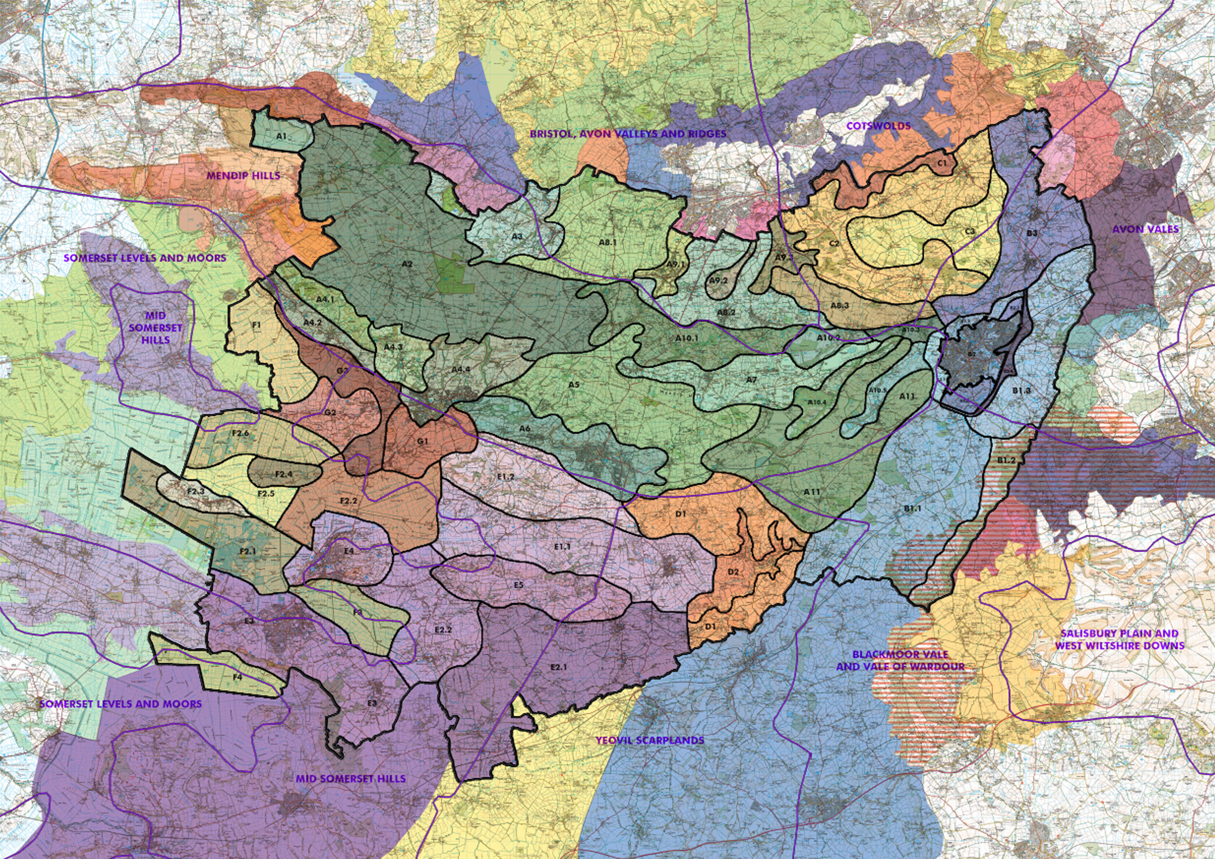
The character areas generally correlate with the 1996 principal character areas. Two subtle differences are noted in relation to the coverage. Around Frome the NCA has a split between the Avon Vales that extend into Wiltshire and the Blackmoor Vale that extends into South Somerset. In the 1996 assessment (and this study) the area is treated as one following the River Frome catchment to the north east corner of the district (LCA areas B1 – B3 Section 6.3). West of Wells a line of small hills at the foot of the Mendip scarp is on the boundary between the NCA Mendip and Levels Areas. As the area is distinct from both these wider landscapes it is identified within the 1996 study (and again here) as a separate principal character area, the Wookey Islands.
A summary of the results from previous assessment is available here.
To compare the character boundaries between the last and current assessments, please click onto the button below for more information.

Mendip in Context
The geology and topography have clearly dictated the pattern of settlement and infrastructure in the region. With the Bristol Channel and docks located as they are and major routes of canals, railways and the later M4 motorway, the more strategic development is located on the east west axis orientated towards London, well to the north of the district. The outcrop of coalfields and minor iron workings on the north side of the Mendips contributed further to the urbanisation on that side of the ridge, but are not reflected on the southern edge. The hills were crossed by several railways, but with fewer major destinations to the south, these were amongst the many lines cut in the post war rationalisation of the network.
Neighbourhood Character Areas
A comparison between proposed landscape character areas with adjoining character areas.