Mendip by Numbers
Landscape Data Base
As part of the landscape assessment various different types of landscape features and areas have been identified and referred to within the report. The measure of these helps provide some good indicators for the state of the Local Environment.
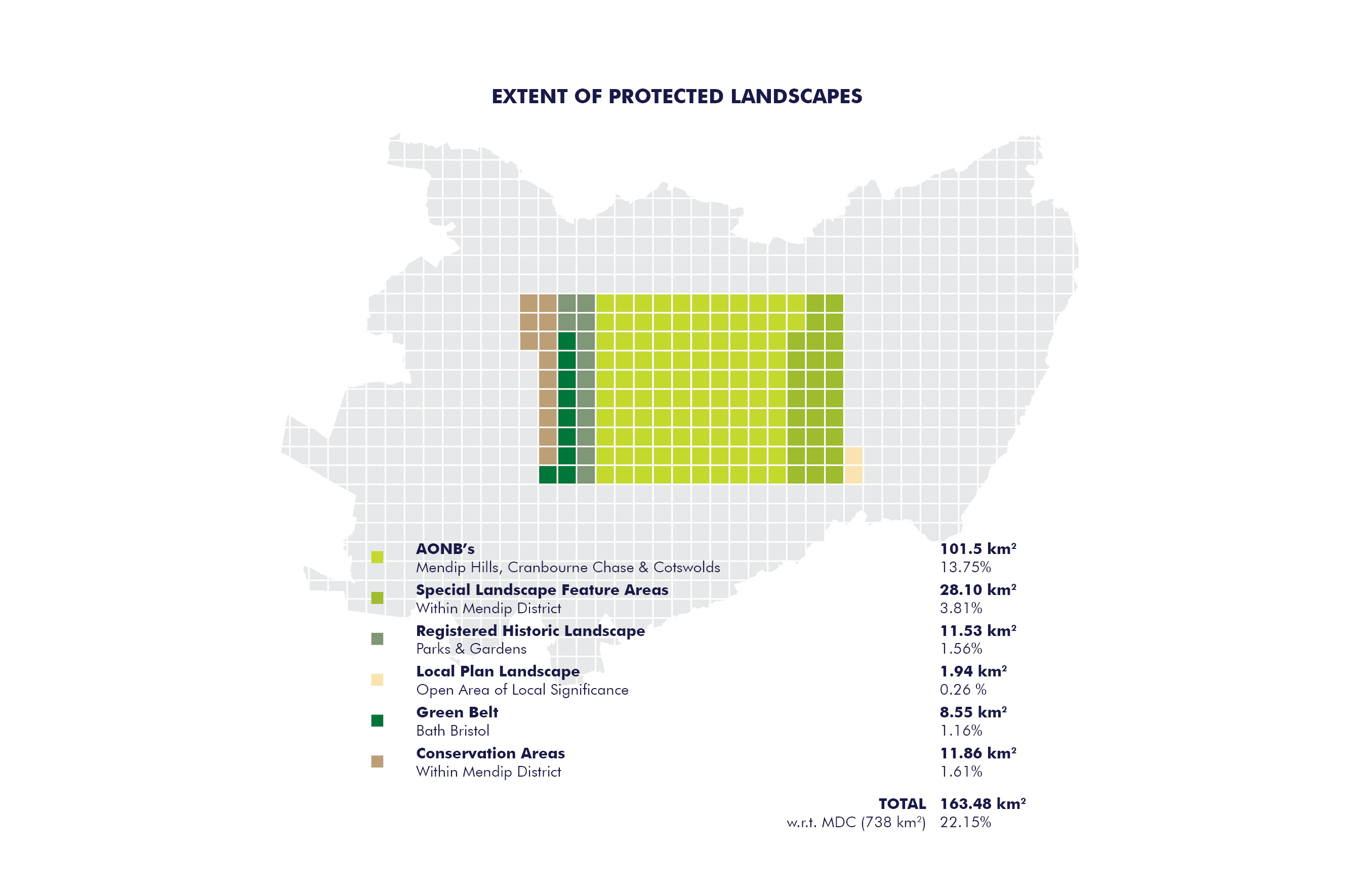
For example, 15,818 ha (158 km²) of the district are identified as being protected by Green Belt or a landscape related planning policy (this equates to 21% of the MDC area).
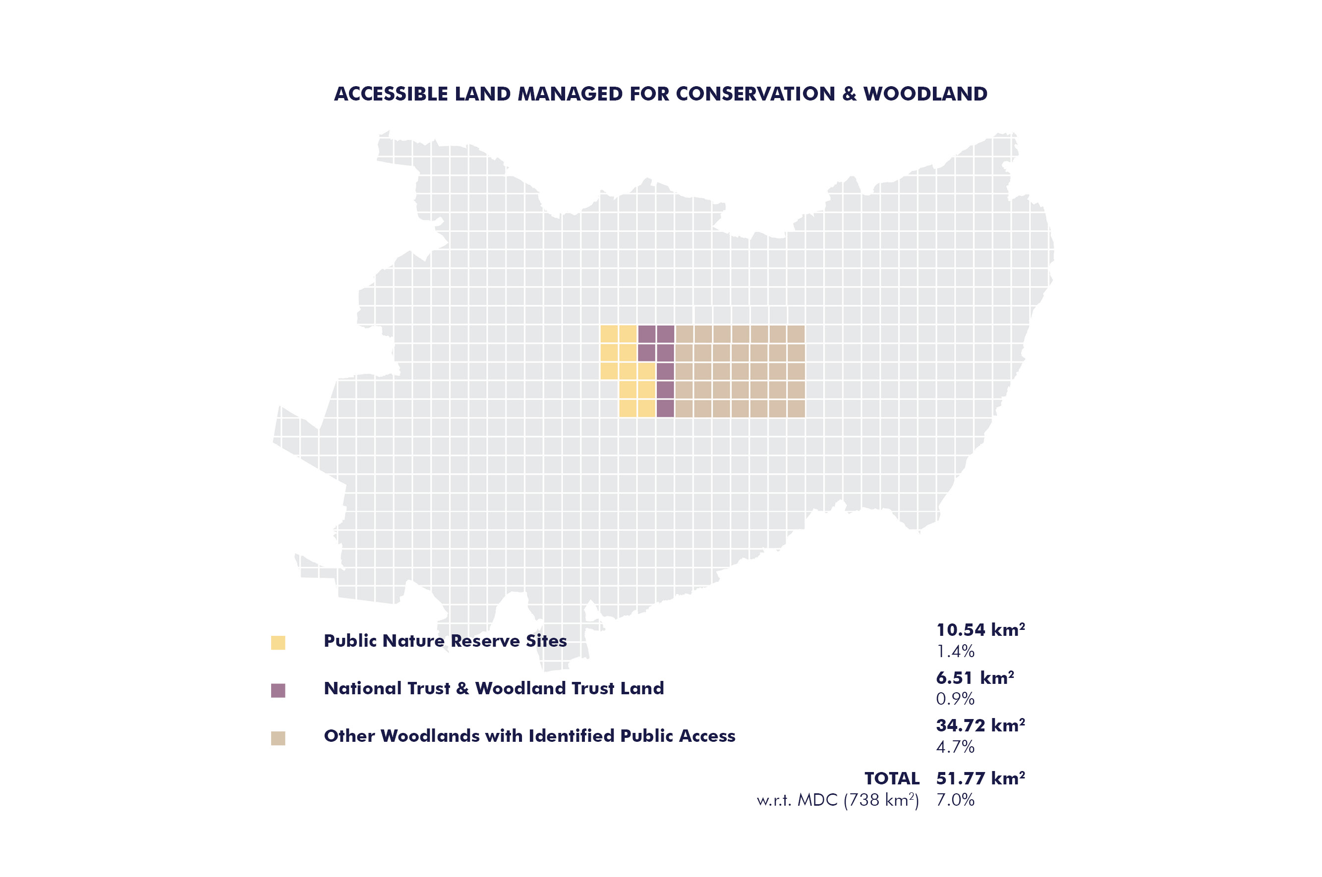
Another measure reflects the interests of nature conservation in the form of the 7,200 ha of ecological designations and nature reserves across the district (just under 10% of the district).
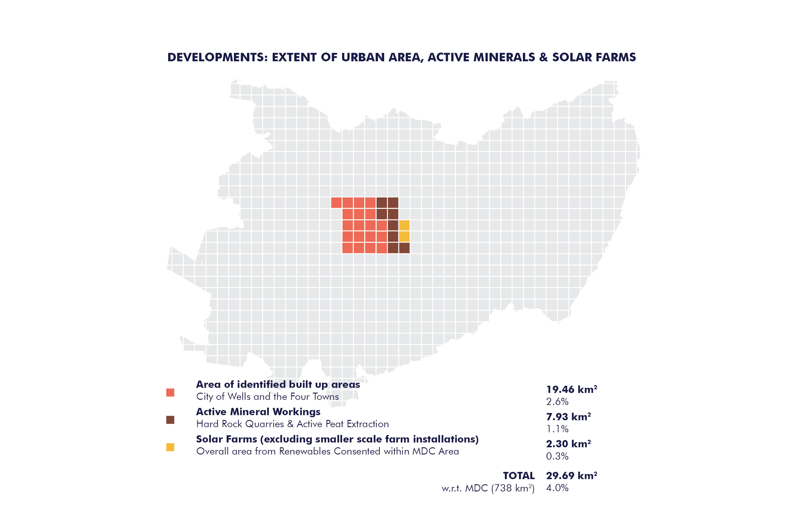
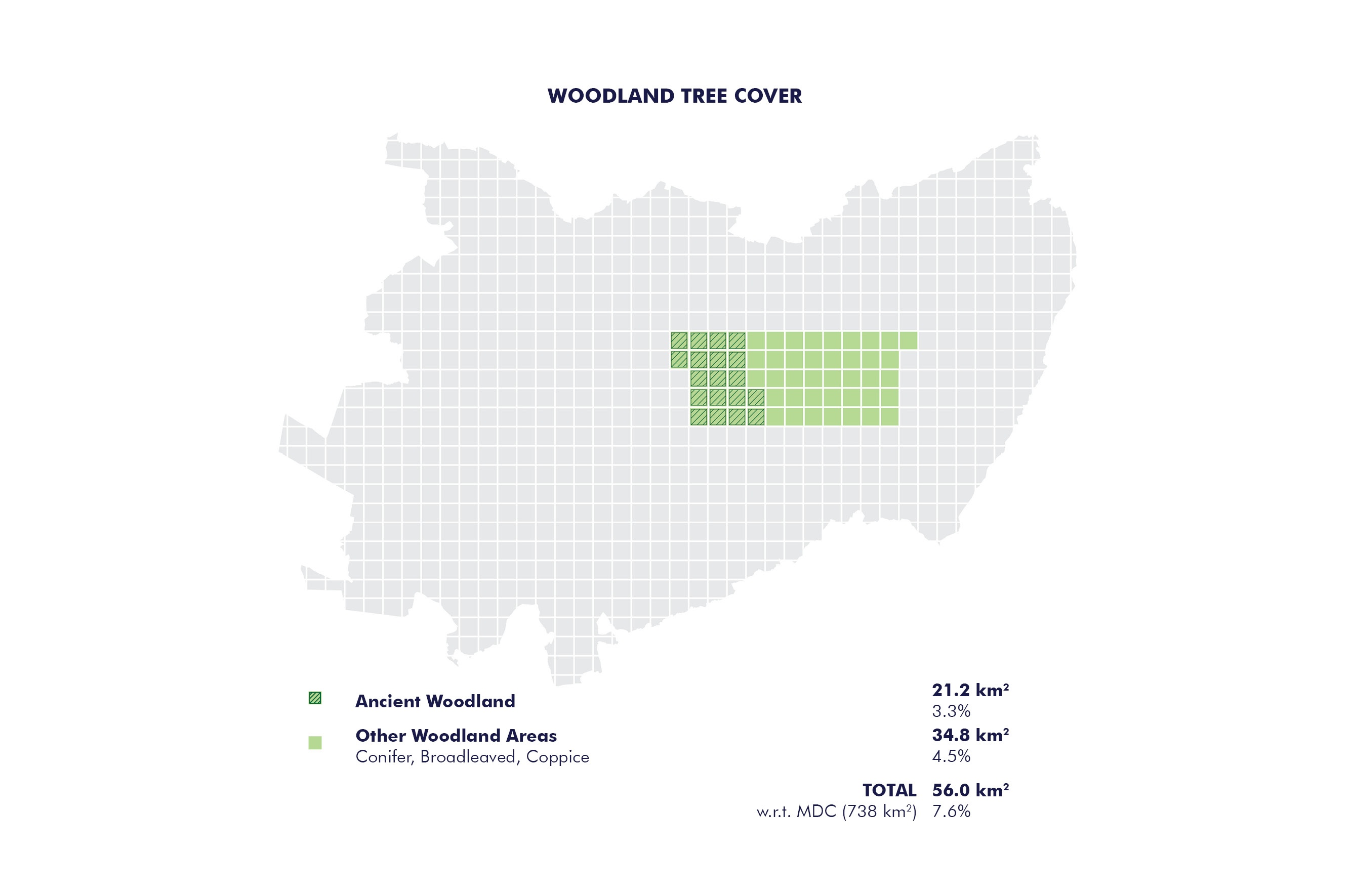
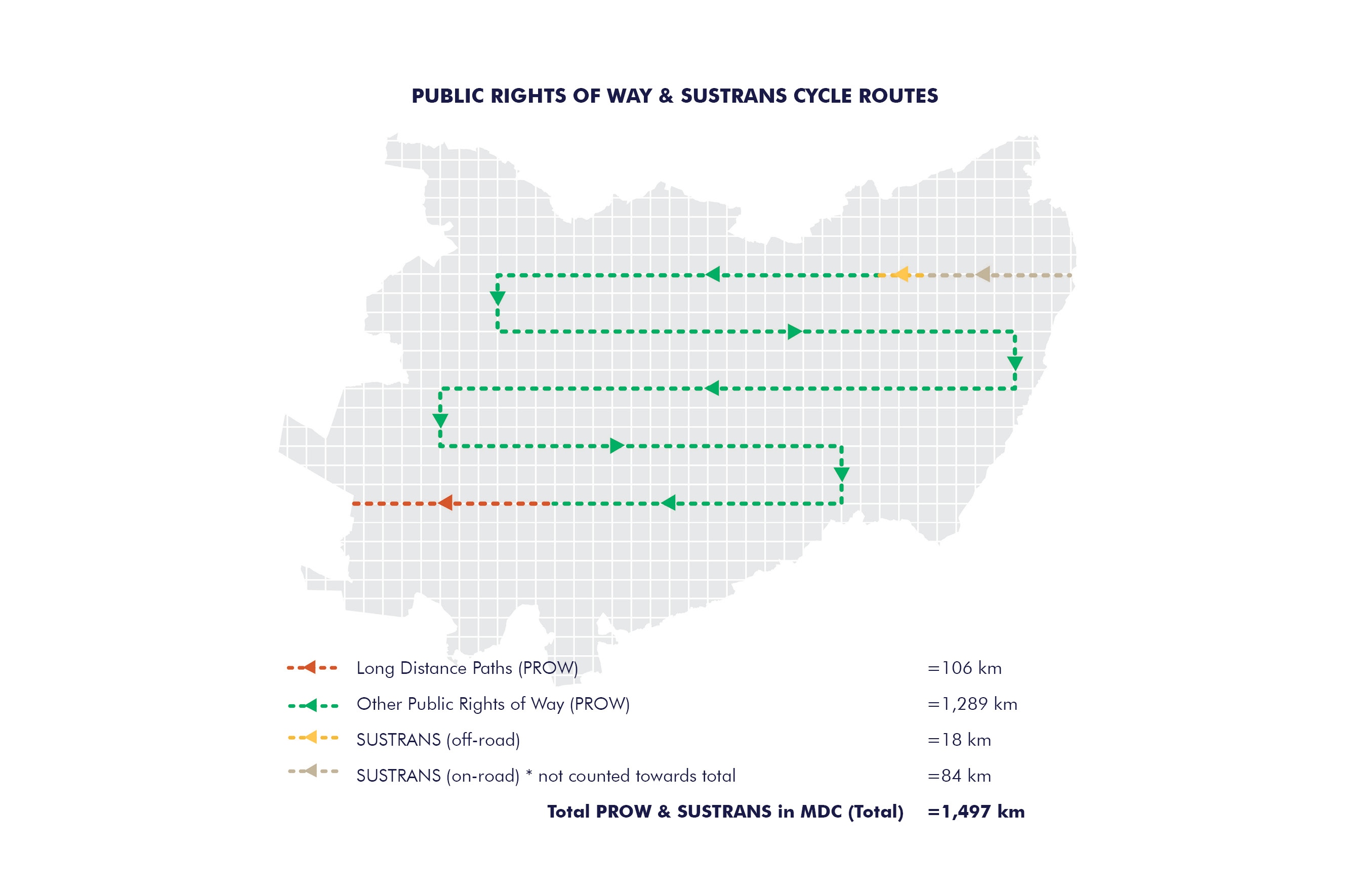
Other measured areas relate to the extent of open access land, rights of way and other trails, woodland cover, ancient woodlands, mineral extraction and renewable energy sites. GIS related information on views and landmarks and local historic features are also included.
During the study this information has been collated into a comprehensive database that allows information to be filtered, searched and viewed as a record of the current conditions. It is envisaged future updates of the landscape assessment will allow changes in these various measures to be monitored over time.
The database can be downloaded and saved for use in relation to further studies and may be of value in the future to further work on Green Infrastructure. Changes made to the database will not be saved on this website but consultation feedback on the content is welcome.
Mendip District Council take no responsibility for any third-party use of the data provided. The information is freely available for non-commercial use or education purposes.
To access the database, please click here for more information.
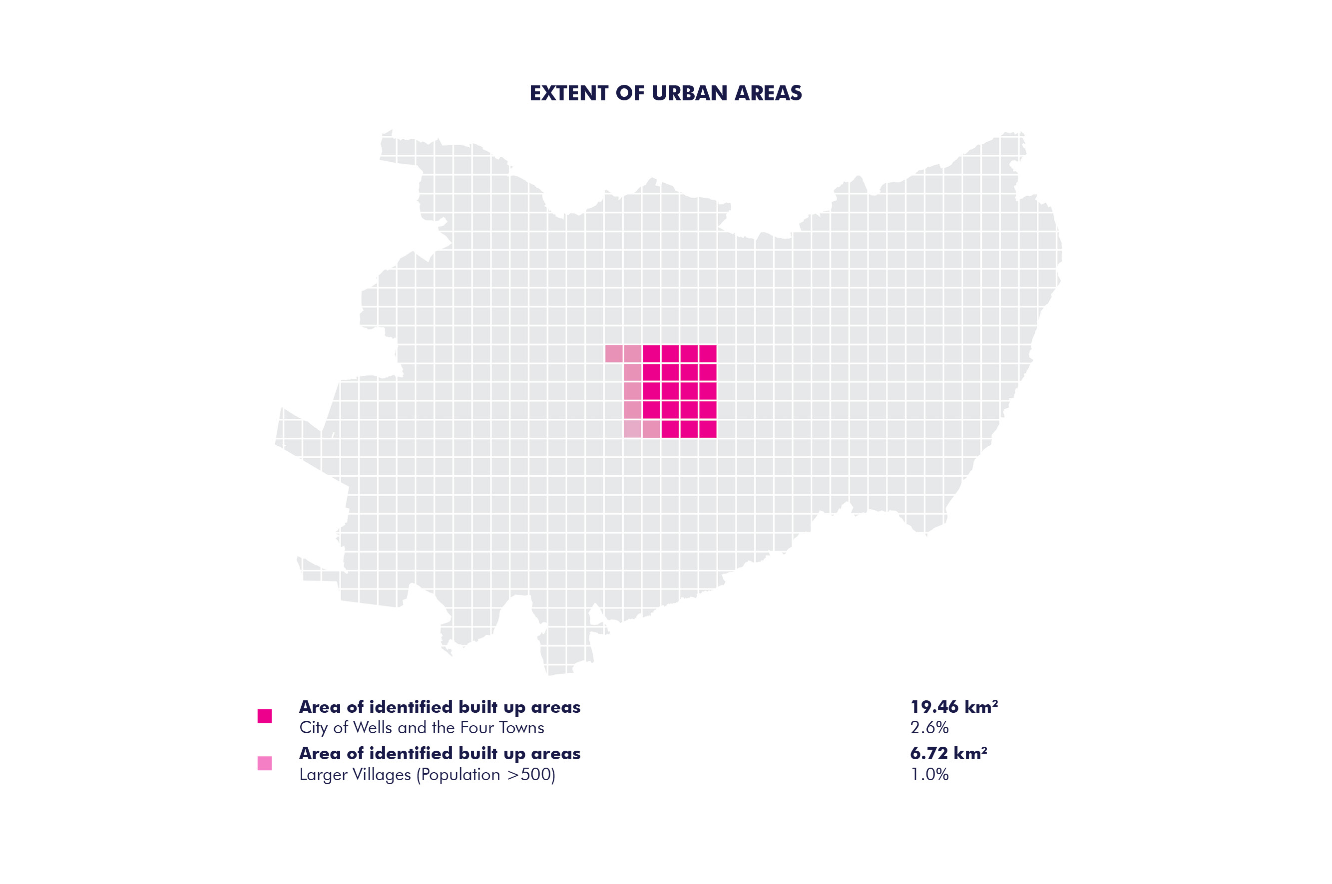
For the diagrams in the slider above, please click here. The full report can be downloaded here.